All you need to know about Descartes Labs' new web application for viewing deformation results from InSAR data
Descartes Labs is proud to announce the release of Iris, a new online interface for viewing and analyzing InSAR results over your engineered infrastructure sites.

InSAR Analysis at Descartes Labs
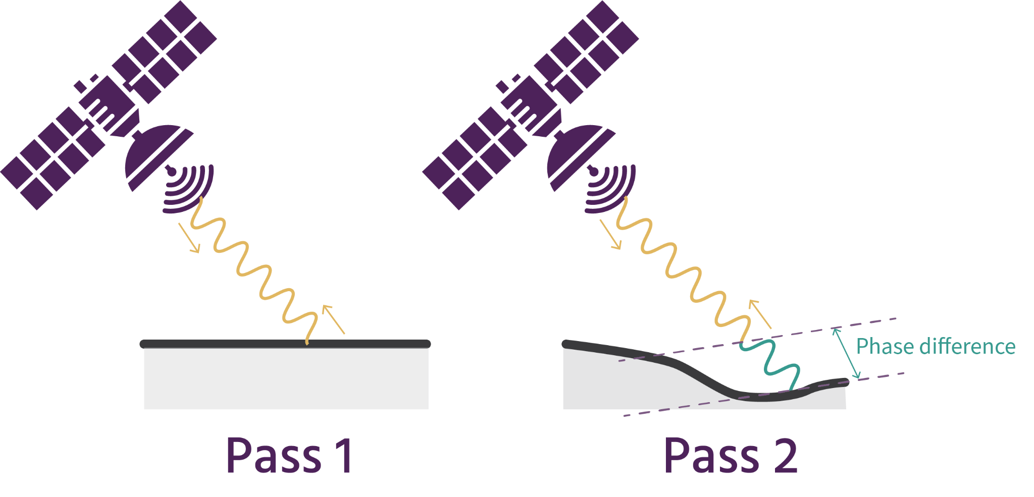
InSAR (interferometric synthetic aperture radar) is a powerful remote sensing tool that uses active sensor data to monitor large critical assets like tailings storage facilities. Subtle deformation that can be measured by InSAR has historically been shown to precede catastrophic failure events that can lead to loss of life, damage to the environment, supply-chain disruptions, and major financial impacts.
Descartes Labs provides high quality deformation results using SAR imagery for a variety of applications and industries. It does this through a fast and automated pipeline called GDS, Global Deformation System, that has been developed by a team of in-house InSAR scientists. This product is the result of peer-reviewed research and has proven useful and accurate for remote deformation monitoring applications surrounding mining, civil engineering, and critical infrastructure.
Using the GDS pipeline, data from public or private satellite sources like Sentinel-1 or TerraSAR-X is ingested, processed and delivered within 18 hours of collection to provide mm-scale deformation measurements showing subsidence and uplift over manmade structures and natural features.
Iris
Due to the scale of the spatiotemporal data produced by InSAR analysis, distribution and visualization of these data can be a challenge. This is why Descartes Labs has developed Iris, a new dedicated tool for viewing GDS results as soon as they are available to allow users to make insights even faster that can drive decision making on the ground.
Iris has a full suite of visualization and analytical tools, including its state-of-the-art anomaly detection algorithms that can alert users to areas that are showing movement trends outside of their expected behavior. Additionally, subscribed users will also have access to Quicklook, a tool that can produce on-demand deformation analyses using Sentinel-1 data at slightly lower resolution anywhere in the world serving as a fast and powerful tool for assessing regional trends or determining if an area warrants closer attention.

Getting Started
This series of Knowledge Base articles is designed to get you started using Iris. It will give you an overview of the interface and types of data layers available delivered with GDS, and an explanation of the tools and features that will help you get the most out of your data.
Use the series of links below to acquaint yourself with Iris!
4. Using Quicklook (coming soon)